
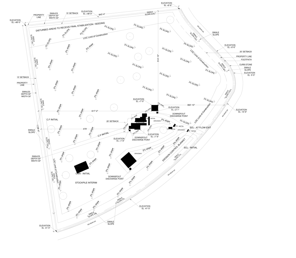
CivilDraft completed a drainage, erosion and sediment control (DESC) package for a residential property in Douglas County, Colorado. The drawings bring site grading, roof runoff, swale routing and construction controls into one coordinated site document.
Site grading and drainage planning
The grading plan identifies existing structures, a proposed garage, driveways, property boundaries and setback lines. Elevation references and slope annotations describe how surface water is intended to move across the property and around the building areas.
Drainage routes need to work together. A downspout outlet affects the adjacent grade; that grade must connect to a receiving swale. The documentation places those relationships on the same drawing so the intended route can be followed through the site.
- Grading slopes and spot elevation references.
- Swale locations and longitudinal slope annotations.
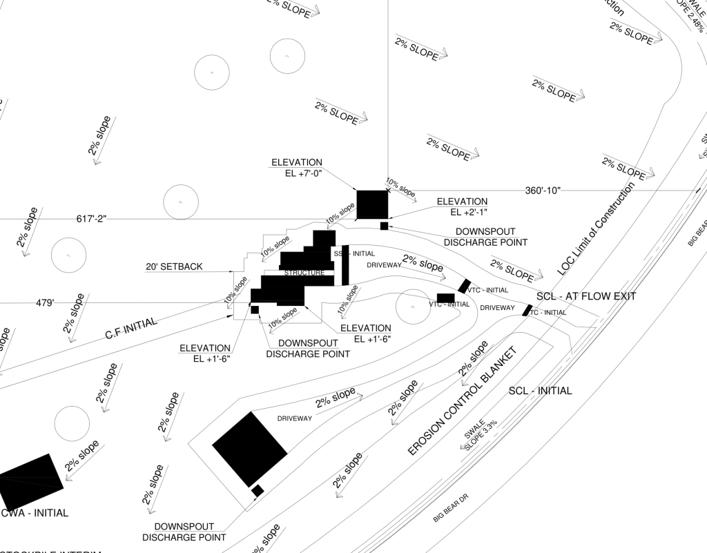
- Roof-downspout discharge points near the buildings.
- Coordination with driveways, setbacks and construction limits.
Roof runoff and building-area coordination
The downspout detail directs roof drainage toward designated surface swales. Notes address discharge away from foundations and neighboring properties, with splash blocks or energy dissipation at outlets to limit local erosion.
The site drawing also distinguishes broad grading areas from the more constrained spaces beside structures and access routes. Keeping these conditions visible helps contractors locate the intended drainage connections without relying on a general note alone.
Erosion and sediment control documentation
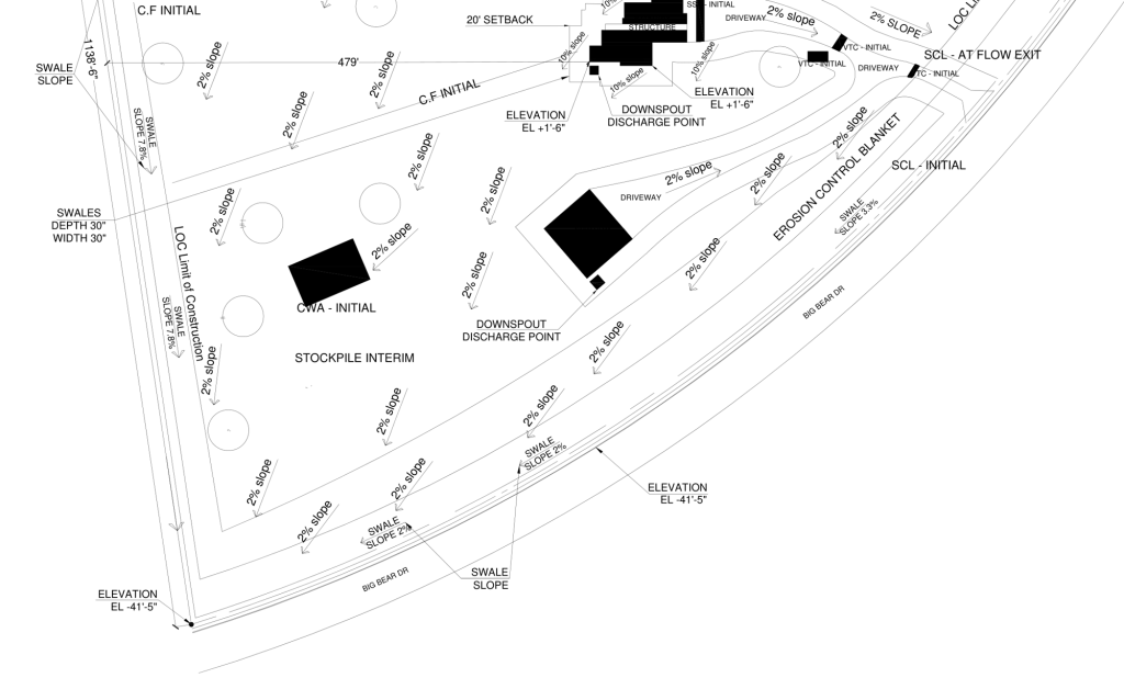
The DESC package includes limits of construction and annotations for construction-phase controls. The drawing identifies initial control locations, vehicle tracking control, a concrete washout area, interim stockpile management, erosion-control blanket areas and final stabilization notes.
These annotations connect temporary construction measures with the finished drainage layout. Disturbed areas are identified for stabilization and seeding, while flow-exit controls are marked in relation to runoff routes.
A coordinated DESC drawing package
CivilDraft’s scope covered the DESC package, including grading and erosion-control documentation. The completed work records the proposed drainage arrangement and the construction controls needed to communicate that design.
Project status: design completed.
Request grading and erosion-control drafting
Send your property location, survey or available site plan, proposed work and any review comments. CivilDraft will assess the available information and define the drawing scope, fee and production schedule.
Request a DESC drafting quote Email your project details Contact CivilDraft on WhatsApp